Project setup
You can follow the general setup and tutorials for qfield project creation :
- (French) INRAP – Utilisation de QField
- (English & French) QField Ecosystem documentation
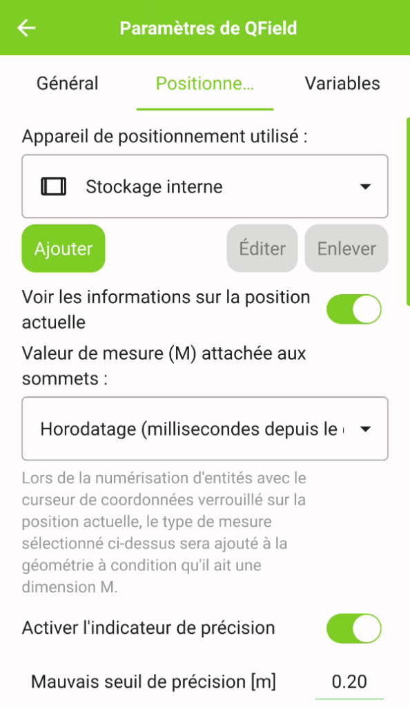
If you are planning to acquire and use later elevation coordinates, you must add the Z dimension when you create your survey layer (you can also add the M dimension, useful for storing the measurement timestamp)
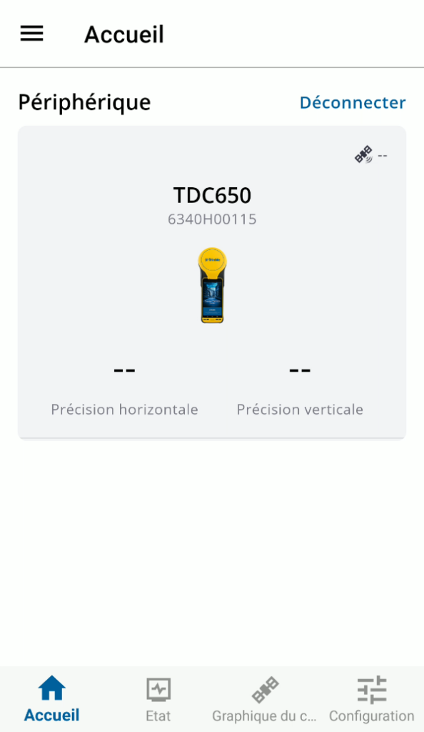
Trimble Mobile Manager
First you need to connect the phone to the internal GNSS antenna
Now, go to the configuration tab and change Géoïde to RAF20 (France)
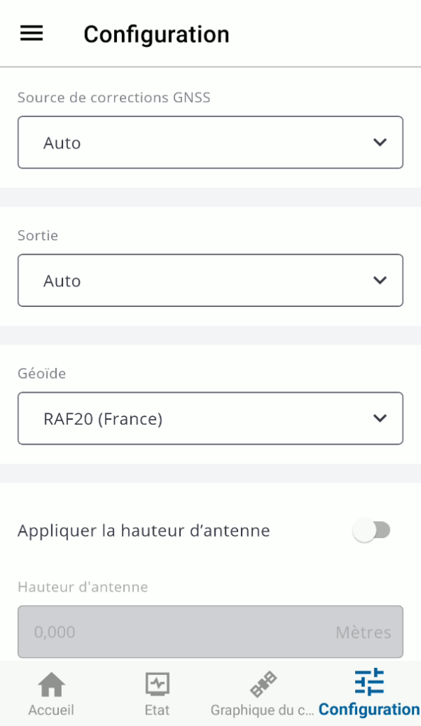
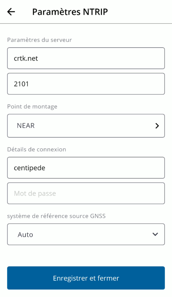
Define the source of correction as custom, and select NTRIP server
And fill with following parameters (from https://docs.centipede.fr/docs/proprietaire/ )
Save and now your position will be estimated using the internal antenna with corrections from the Centipede network
QField